
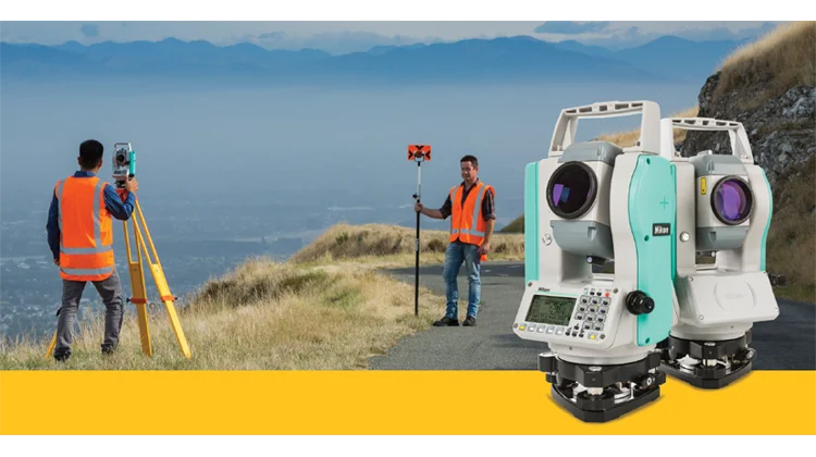
Land survey companies in Uganda provide measurements, plans and spatial information for property boundaries, subdivisions, construction and infrastructure development. Their work helps landowners, developers, engineers and institutions understand the physical characteristics and surveyed layout of a site.
The service required depends on the task. Confirming an existing boundary differs from preparing a topographic survey for building design. Subdividing land, setting out construction works and mapping an infrastructure corridor also require clearly defined instructions.
This list of land survey companies in Uganda features 10 firms with published land-surveying services. It includes their advertised capabilities, available locations and telephone contacts to help you prepare a shortlist.
The companies appear in no particular order. Inclusion does not certify their current professional standing. Before commissioning an assignment, identify the responsible land surveyor and verify their registration and current practising certificate.
Land Survey Companies in Uganda at a Glance
| No. | Company | Published land-surveying services | Location or coverage |
|---|---|---|---|
| 1 | Surveco | Cadastral surveys, topographic surveys and digital mapping | Uganda |
| 2 | Mapkomp Surveyors | Cadastral surveys, boundary work and engineering surveys | Kampala |
| 3 | BMO Surveys & Consulting Partners | Boundary surveys, subdivisions, topographic and construction surveys | Nansana |
| 4 | COGO Engineering and Mapping Surveyors | Cadastral, topographic, engineering and mapping surveys | Kampala; Uganda and regional projects |
| 5 | Spot Surveyors and Engineering Consultants | Boundary opening, subdivisions, cadastral and infrastructure surveys | Kampala |
| 6 | GMT Consults Limited | Boundary verification, cadastral surveys, topographic surveys and GIS | Kampala |
| 7 | Elbits Consulting Surveyors & Chartered Valuers | Boundary, topographic and cadastral surveys | Kisasi–Kyanja, Kampala |
| 8 | Yvetline Consulting Valuers and Surveyors | Boundary surveys, subdivisions and engineering surveys | Kampala |
| 9 | Hisec Cadastral & Engineering Surveyors Limited | Cadastral surveys, engineering surveys and mapping | Uganda |
| 10 | Ramani Geosystems / Ramani Land Services | Land, cadastral, topographic and geodetic surveys | Kampala office |
1. Surveco
Surveco is a Ugandan consultancy offering land surveying, engineering surveying and digital mapping.
Its published company information identifies cadastral surveys, topographic surveys and geographic information systems among its capabilities. The firm also describes using total stations, GPS equipment and computer-based survey processing.
Surveco is an option to contact when you need measured property information or survey data for a development project.
Published services include:
- Land and cadastral surveying.
- Topographic surveys.
- Engineering surveys.
- Digital mapping.
- Geographic information systems.
Published office telephone: +256 434 660441.
Published mobile contacts: +256 712 417749 or +256 782 388214.
When requesting a quotation, specify whether you need boundary work, a site survey for design or another service. Confirm the records review, fieldwork and final documentation included in the fee.
2. Mapkomp Surveyors
Mapkomp Surveyors advertises land and engineering surveying, including cadastral work and digital mapping.
Its website describes a process that combines review of available land records with field measurements, analysis and reporting. It also identifies the use of GNSS equipment, total stations and drone imagery where appropriate.
This combination is relevant to clients who need survey findings presented alongside the available property documentation.
Published services include:
- Cadastral surveying.
- Boundary demarcation.
- Land and engineering surveys.
- Digital mapping.
- Drone-assisted photogrammetry.
Address: Insurance House, Jinja Road, Suite F09, First Floor, Kampala.
Telephone: +256 705 961137 or +256 785 802069.
Ask the firm to explain what its report will establish, which records it will review and whether any additional submission work is included.
3. BMO Surveys & Consulting Partners
BMO Surveys & Consulting Partners advertises land surveying, engineering surveys, mapping and land-documentation support.
Its land services include boundary surveys, subdivision surveys, topographic surveys and re-establishment of lost boundaries. It also publishes construction services such as setting out and as-built surveys.
The firm additionally offers GIS mapping and survey support for resettlement action plans.
Published services include:
- Boundary surveys.
- Subdivision surveys.
- Topographic surveys.
- Re-establishment of lost boundaries.
- Construction setting out and as-built surveys.
- Mapping and GIS.
Address: Second Floor, Room 2B, Nansana Heights Building, Hoima Road.
Telephone: +256 773 587109.
For subdivision or boundary assignments, provide the available property documents and ask for a written explanation of the required stages and deliverables.
4. COGO Engineering and Mapping Surveyors
COGO Engineering and Mapping Surveyors advertises cadastral, engineering and mapping surveys in Uganda and East Africa.
Its published services cover boundary and title-related surveys, topographic surveys, survey control, setting out and structural monitoring. The company also describes work supporting land acquisition and infrastructure development.
COGO’s service range is relevant to both individual property assignments and larger projects requiring coordinated survey information.
Published services include:
- Cadastral surveys.
- Topographic and feasibility surveys.
- Engineering surveys.
- Survey control.
- Construction setting out.
- Mapping and land-acquisition support.
Published base: Kampala.
Request the current office contact and identify the intended use of the survey. For engineering assignments, ask the firm to agree on the required accuracy, coordinate system and digital deliverables with your project team.
5. Spot Surveyors and Engineering Consultants
Spot Surveyors and Engineering Consultants publishes land-surveying services covering cadastral work, boundary opening, subdivisions and infrastructure surveys.
Its website provides examples involving roads, transmission lines and land-related development projects. Its cadastral services page also describes survey work associated with titling and resettlement projects.
These references give prospective clients a basis for requesting experience relevant to their particular assignment.
Published services include:
- Cadastral surveys.
- Boundary opening.
- Subdivision surveys.
- Topographic and infrastructure surveys.
- GPS surveys.
- Aerial surveys and mapping.
Address: Plot 364, Kanyike Road, Kampala.
Telephone: +256 782 036862.
Ask for examples matching your project’s size and purpose. Confirm whether the proposed appointment covers field measurements alone or also includes plans, reporting and submission support.
6. GMT Consults Limited
GMT Consults Limited is a multidisciplinary consultancy with a published land-surveying service offering.
Its services include cadastral surveys, boundary verification, survey control, topographic surveys, civil engineering surveys and GIS mapping. It also advertises alignment surveys, including road surveys and strip mapping.
The company’s wider work includes land access, resettlement, valuation and property consultancy. These should be separately defined if included in the same appointment.
Published services include:
- Cadastral surveys.
- Boundary verification.
- Control and topographic surveys.
- Civil engineering surveys.
- Alignment surveys and strip mapping.
- GIS mapping.
Address: Plot 112, Bukoto Street, Kampala.
Telephone: +256 200 902091.
Request an itemised proposal identifying the surveying tasks, responsible professional, deliverables and any additional consultancy services.
7. Elbits Consulting Surveyors & Chartered Valuers
Elbits Consulting Surveyors & Chartered Valuers advertises land surveying alongside property valuation and real estate consultancy.
Its published land-surveying services include boundary, topographic and cadastral surveys. The firm also lists land-documentation support and civil design among its wider activities.
Clients should specify whether they require a survey only or a combined assignment involving valuation or property advice.
Published services include:
- Boundary surveys.
- Topographic surveys.
- Cadastral surveys.
- Land-documentation support.
- Related property consultancy.
Published location: Kisasi–Kyanja, Kampala.
Telephone: +256 785 107741 or +256 773 864760.
Ask which professional will supervise and sign the survey work. For a combined service, request separate descriptions of the surveying and valuation outputs.
8. Yvetline Consulting Valuers and Surveyors
Yvetline Consulting Valuers and Surveyors is a Kampala-based property consultancy advertising several types of land surveys.
Its published services include boundary, cadastral, topographic, subdivision and engineering surveys. It also offers property valuation, feasibility studies and development consultancy.
The firm’s service range is relevant to clients planning property development or seeking different professional assessments of the same site.
Published services include:
- Boundary and cadastral surveys.
- Topographic surveys.
- Subdivision surveys.
- Engineering surveys.
- Setting out, site control and as-built surveys.
Published office location: Bukoto–Kisasi Road, Kampala.
Telephone: +256 708 319798 or +256 785 740193.
Explain the purpose of the appointment and who will use the results. Ask the firm to distinguish the survey fee from any valuation or development-consultancy charges.
9. Hisec Cadastral & Engineering Surveyors Limited
Hisec Cadastral & Engineering Surveyors Limited is listed in a Ugandan business directory as providing cadastral surveys, engineering surveys, GIS and mapping.
The published profile also describes surveying equipment distribution. Equipment supply and professional survey services are different activities, so confirm which service your quotation covers.
This listing is based on the available directory information; prospective clients should obtain an updated company profile directly.
Listed services include:
- Cadastral surveys.
- Engineering surveys.
- GIS.
- Mapping.
- Surveying equipment supply.
Directory-listed telephone: +256 781 003388.
Before arranging fieldwork, confirm the current office address, responsible land surveyor and professional credentials for the assignment.
10. Ramani Geosystems / Ramani Land Services
Ramani publishes a land-services offering covering conventional land surveys, topographic surveys, geodetic surveys, cadastral services and terrestrial LiDAR surveys.
The group also provides wider geospatial services, including aerial photography and mapping. Its published contact information includes a Uganda office in Kampala.
Ramani is relevant to enquiries requiring land measurements together with more extensive mapping or spatial-data services.
Published services include:
- Conventional land surveys.
- Cadastral surveys.
- Topographic surveys.
- Geodetic surveys.
- Terrestrial LiDAR surveys.
- Geospatial mapping.
Published Uganda address: Plot 30, Kanjokya Street, Kampala.
Published Uganda telephone: +256 773 261995.
Confirm the current Uganda office details and ask which local professional and contracting entity would be responsible for your survey.
How to Choose a Land Survey Company in Uganda
Identify the Survey You Need
Begin with the outcome you want. Boundary verification, subdivision, topographic mapping and construction setting out are different assignments.
Explain the property location, available documentation and the decision or project the survey will support. Ask the firm to describe the appropriate service before agreeing on a price.
Verify the Responsible Land Surveyor
The Surveyors Registration Board states that practising surveyors require a registration certificate and a valid practising certificate.
Ask for the full name and registration details of the individual responsible for the work. Confirm their current status and relevant discipline with the Board.
Do not rely solely on a company’s business registration, equipment ownership or an old professional listing.
Request Relevant Experience
Ask about completed assignments similar to yours. A small residential boundary survey differs from mapping a large estate or an infrastructure corridor.
For complex projects, request examples of reports or drawings with confidential client information removed. This can help you assess whether the proposed outputs match your needs.
Agree on Deliverables Before Fieldwork
Your written appointment should explain what you will receive and what is excluded.
Clarify whether the service includes a site visit, measurements, boundary marking, plans, a report, digital files and any necessary submission support. Avoid assuming that every task is included in a general “survey fee.”
Common Land Survey Services
| Service | Purpose to discuss with the firm |
|---|---|
| Boundary survey | Checking or establishing the surveyed position of property boundaries |
| Cadastral survey | Survey work associated with defined land parcels and land records |
| Subdivision survey | Surveying proposed divisions of a larger parcel |
| Topographic survey | Recording terrain, levels and physical features for planning or design |
| Engineering survey | Providing measurements and survey control for infrastructure or construction |
| Setting out | Transferring the position of proposed works from drawings to the site |
| As-built survey | Recording the measured position of completed works |
| GIS and digital mapping | Organising and presenting spatial information |
Ask the firm to explain which service matches your intended use and whether additional professional work is required.
What Should a Land Survey Quotation Include?
| Quotation item | What to check |
|---|---|
| Property identification | The location and parcel or project being surveyed |
| Scope | The exact survey tasks included |
| Responsible professional | Who will supervise and sign the work |
| Records review | Which existing records will be obtained or examined |
| Fieldwork | Site visits, coverage and access arrangements |
| Deliverables | Plans, reports, coordinates and digital files |
| Submission support | Whether follow-up with relevant offices is included |
| Programme | Expected fieldwork and reporting dates |
| Fees | Professional charges, transport, taxes and other costs |
| Exclusions | Additional visits, extra work or separately payable services |
Compare proposals against the same scope. A low quotation may exclude records searches, additional site visits or final documentation included by another firm.
How Much Does Land Surveying Cost in Uganda?
A useful quotation depends on the assignment. Site location, size, access, available records, required measurements and final deliverables can all affect the proposed fee.
Ask for an itemised estimate rather than assuming that a standard price applies to every plot or project.
Where administrative or submission charges apply, request that they be shown separately from the firm’s professional fee. Agree in writing on how additional work will be authorised.
Frequently Asked Questions
Which Companies Offer Land Surveys in Uganda?
Examples include Surveco, Mapkomp Surveyors, BMO Surveys & Consulting Partners, COGO Engineering and Mapping Surveyors, Spot Surveyors, GMT Consults, Elbits, Yvetline Consulting, Hisec and Ramani.
Can These Companies Survey Land Outside Kampala?
Several describe services across Uganda or the wider region. Confirm availability for your district and ask whether transport, accommodation or mobilisation charges apply.
Is a Land Survey the Same as a Property Valuation?
No. A land survey concerns measurements, boundaries or other spatial information. A valuation provides an assessment of value for a stated purpose. Some firms offer both, but they should be separately defined.
Read Also; The Best Infrastructure & Construction Companies in Singapore
Can a Survey Company Help with Subdivision?
Several firms on this list advertise subdivision or cadastral services. Ask what survey work, documentation and submission support their appointment includes, and clarify which approvals remain outside their control.
What Should I Prepare Before Contacting a Surveyor?
Prepare the site location, available property documents, existing survey plans and a clear explanation of the work required. Mention access restrictions and any known disagreement about the boundary.
What Should I Receive When the Work Is Finished?
The agreed outputs may include a signed report, plans, coordinates or digital survey files. Your written scope should state what will be delivered, who will sign it and whether any further processing remains outstanding.
Editorial research notes — outside the article
The company descriptions and contacts above were checked against the following published information:
- Surveco: Land, cadastral and topographic services and published telephone contacts. survecoug.com
- Mapkomp: Cadastral and engineering services, office location and contacts. Land Surveying & Digital Mapping Uganda
- BMO: Land-surveying services, Nansana address and telephone. BMO Survey and Consultants
- COGO: Published cadastral, topographic and engineering survey offering. COGO Engineering & Mapping Surveyors
- Spot Surveyors: Cadastral services, project examples and Kampala contacts. Spot Surveyors and Engineering Consultants
- GMT Consults: Surveying service list and current published office details. gmtconsults.com
- Elbits: Boundary, topographic and cadastral services and contacts. Kampala, Uganda
- Yvetline: Survey types, office location and telephone numbers. yvetlineconsulting.com
- Hisec: Directory-listed services and telephone; its website could not be accessed during this check. africa2trust.com
- Ramani: Land-services offering and published Uganda office details. Ramani Geosystems
- Professional verification: The Surveyors Registration Board requires registration and a valid practising certificate. Its retrieved public membership page was labelled 2025, so it does not establish current 2026 status for the listed firms’ personnel. srb.go.ug
Do you like this personality?