
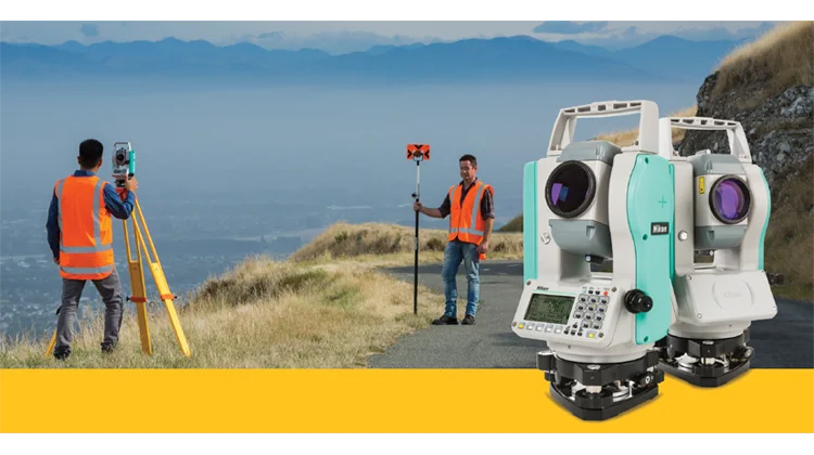
Surveyors in Uganda provide different services, from measuring property boundaries and mapping terrain to estimating construction costs and valuing real estate. Choosing the right professional starts with identifying the type of survey you need.
For example, a boundary survey requires land-surveying expertise, while a construction cost assessment calls for quantity surveying. A property valuation serves another purpose and should not be confused with either service.
Read Also;List of Bridge Contractors in Uganda
This list of surveyors in Uganda focuses on 10 firms offering surveying or closely related professional services. It includes land and engineering surveying businesses, mapping specialists and property consultancies, with their advertised services and available contacts.
The entries are not ranked. Inclusion does not confirm the current practising status of every professional employed by a firm. Before commissioning work, identify the individual responsible for the assignment and verify their credentials for the relevant discipline.
Surveying Firms in Uganda at a Glance
| No. | Firm | Published service focus |
|---|---|---|
| 1 | Surveco | Land surveying, engineering surveying and digital mapping |
| 2 | Mapkomp Surveyors | Land and engineering surveys, boundary work and digital mapping |
| 3 | BMO Surveys & Consulting Partners | Boundary surveys, subdivisions, construction surveys and GIS |
| 4 | COGO Engineering and Mapping Surveyors | Cadastral, engineering and topographic surveys |
| 5 | Yvetline Consulting Valuers and Surveyors | Property valuation, land surveying and development consultancy |
| 6 | East African Consulting Surveyors and Valuers | Valuation, quantity surveying and property services |
| 7 | Professional Engineering Consultants Limited | Engineering surveys, route surveys and GIS |
| 8 | MBW Consulting Limited | Topographical surveys and infrastructure consultancy |
| 9 | Trio Consultants Limited | Engineering surveys and infrastructure consultancy |
| 10 | Punta360 | Drone surveys, mapping, remote sensing and inspections |
1. Surveco
Surveco is a Ugandan consultancy describing its team as surveyors, valuers, engineers and land-management consultants.
Its published surveying services include land surveying, engineering surveying and digital mapping. The company also identifies cadastral surveys, topographic surveys and geographic information systems among its capabilities.
This service range makes it relevant to clients seeking property measurements or spatial information for development projects.
Published services include:
- Land and cadastral surveys.
- Topographic surveys.
- Engineering surveying.
- Digital mapping and GIS.
Published office telephone: +256 434 660441.
Published mobile contacts: +256 712 417749 or +256 782 388214.
Ask which survey deliverables are included, who will sign the final documentation and whether any submission or follow-up work is covered by the fee. survecoug.com
2. Mapkomp Surveyors
Mapkomp Surveyors advertises land and engineering surveying alongside digital mapping services.
Its website describes a process involving review of available property records, field measurements, analysis and reporting. It also identifies the use of GNSS equipment, total stations and drone imagery where appropriate.
Clients can approach the firm for enquiries about boundary measurements, site information and mapping requirements.
Published services include:
- Land and engineering surveying.
- Boundary demarcation.
- Digital mapping.
- Drone-assisted photogrammetry.
- Spatial-data services.
Address: Insurance House, Jinja Road, Suite F09, First Floor, Kampala.
Telephone: +256 705 961137 or +256 785 802069.
Provide the property location and explain whether you need boundary verification, a development survey or a mapping assignment. Land Surveying & Digital Mapping Uganda
3. BMO Surveys & Consulting Partners
BMO Surveys & Consulting Partners advertises land surveying, engineering surveys, GIS mapping and survey support for resettlement action plans.
Its published land services include boundary surveys, subdivision surveys, topographic surveys and re-establishment of lost boundaries. Construction-related services include setting out and as-built surveys.
The firm also advertises surveying equipment sales, which should be distinguished from an appointment to carry out professional survey work.
Published services include:
- Boundary and subdivision surveys.
- Topographic surveys.
- Construction setting out.
- As-built surveys.
- GIS mapping.
- Resettlement action plan survey support.
Address: Second Floor, Room 2B, Nansana Heights Building, Hoima Road.
Telephone: +256 773 587109.
Ask for a written scope identifying the fieldwork, plans, reports and any administrative follow-up included in the quotation. BMO Survey and Consultants
4. COGO Engineering and Mapping Surveyors
COGO Engineering and Mapping Surveyors describes services in engineering, cadastral and mapping surveys, alongside land acquisition and valuation.
Its published topographic surveying offering covers infrastructure and development sectors such as roads, waterlines, powerlines, dams, buildings and agriculture.
The company is relevant to enquiries where survey information must support planning or engineering design.
Published services include:
- Cadastral surveys.
- Engineering surveys.
- Topographic and feasibility surveys.
- Mapping.
- Land acquisition and valuation services.
Published coverage: Uganda and East Africa.
Before commissioning work, request the current office contact, the responsible professional’s details and examples of deliverables for similar assignments. COGO Engineering & Mapping Surveyors
5. Yvetline Consulting Valuers and Surveyors
Yvetline Consulting Valuers and Surveyors is a Kampala-based property consultancy advertising both land surveying and valuation services.
Its land-surveying offering includes boundary, cadastral, topographic, subdivision and engineering surveys. The firm also lists property appraisal, feasibility studies, development consultancy and property management.
Because the service range spans different disciplines, specify the exact purpose of the appointment.
Published services include:
- Boundary and cadastral surveys.
- Topographic and subdivision surveys.
- Engineering surveys.
- Property valuation and appraisal.
- Feasibility studies and development consultancy.
Location: Kampala.
Telephone: +256 708 319798.
For a combined instruction, ask the firm to separate the land-surveying deliverables from the valuation report and identify the professional responsible for each. Yvetline Consulting
6. East African Consulting Surveyors and Valuers
East African Consulting Surveyors and Valuers advertises valuation, quantity surveying, property management and feasibility studies.
Its published services make it relevant to property assessment and construction-cost enquiries. Readers should not assume that every firm with “surveyors” in its name offers boundary surveying; confirm the particular service required.
Published services include:
- Property valuations.
- Quantity surveying.
- Feasibility studies.
- Property management.
Published coverage: The firm describes a branch network within Uganda.
When making an enquiry, state whether you need a valuation, construction-cost service or another property assignment. Confirm the appropriate office and responsible professional directly. eacsv.com
7. Professional Engineering Consultants Limited
Professional Engineering Consultants Limited, commonly known as PEC, publishes a dedicated surveying and GIS service offering.
Its capabilities include geodetic control surveys, real-time kinematic surveys, topographic surveys, route surveys, site analysis, CAD drafting and digital terrain modelling.
These services are particularly relevant to engineering projects that require measured site information for planning and design.
Published services include:
- Survey control.
- Topographic and route surveys.
- Site analysis.
- Digital terrain modelling.
- GIS and spatial-data acquisition.
- Mapping from satellite imagery.
Address: Plot 9, Makajja Close, off Ntinda 2 Road, Naguru, Kampala.
Telephone: +256 393 513038.
Provide the intended use of the survey and ask the firm to confirm the required accuracy, coverage and output formats in its proposal. pec.co.ug
8. MBW Consulting Limited
MBW Consulting Limited is an engineering and infrastructure consultancy whose published services include topographical and geotechnical surveys.
Its wider project categories cover buildings, highways, bridges, drainage, water and sanitation, and oil and gas infrastructure.
The firm is relevant where survey work forms part of a broader engineering investigation or design assignment.
Published relevant services include:
- Topographical surveys.
- Geotechnical investigations.
- Technical studies and assessments.
- Multidisciplinary engineering.
- Infrastructure project management.
Address: Plot 107, Kira Road, Kamwokya, Kampala.
Telephone: +256 393 740800 or +256 701 740800.
Ask whether the proposed fee covers survey work alone or a package of investigations, design and reporting. www.mbw.co.ug
9. Trio Consultants Limited
Trio Consultants Limited appears in the Uganda Association of Consulting Engineers directory with engineering surveys among its specialisations.
Its listed services also include infrastructure planning, feasibility studies, engineering design, geotechnical investigations and construction supervision.
This makes it relevant to clients seeking survey support for road, building or water-infrastructure projects.
Directory-listed services include:
- Engineering surveys.
- Infrastructure planning.
- Feasibility studies.
- Geotechnical investigations.
- Engineering design and supervision.
Address: Trio House, Plot 1683, Kisugu–Mbogo Road, Kampala.
Telephone: +256 414 664242.
Published mobile: +256 772 420502.
Confirm current contacts and ask the firm to define the survey scope and deliverables separately from any additional consultancy services. FIRM LOGO
10. Punta360
Punta360 specialises in unmanned aerial surveys, GIS and remote sensing.
Its published services include construction-site monitoring, aerial photography, infrastructure inspections and environmental mapping. The company describes work across sectors including construction, agriculture, oil and gas, and power infrastructure.
It belongs in this directory as a geospatial and aerial-survey provider. Clients requiring cadastral or boundary certification should specifically confirm whether that service is provided and by whom.
Published services include:
- Drone-based surveys and mapping.
- Topographic drone surveys.
- Construction-site monitoring.
- Infrastructure inspections.
- GIS and remote sensing.
Address: 20 Martyrs Crescent, Ntinda, Kampala.
Telephone: +256 784 002154.
Specify whether you require imagery, mapping, measurements or professional survey certification so the proposal addresses the intended outcome. punta360ug.com
Which Type of Surveyor Do You Need?
The Institution of Surveyors of Uganda recognises several surveying disciplines, including land surveying, quantity surveying, valuation surveying, and mining and hydrological surveying. Your appointment should match the service required. surveyorsofuganda.org
| Your requirement | Service to ask about |
|---|---|
| Confirming plot boundaries | Land or cadastral surveying |
| Preparing terrain information for design | Topographic surveying |
| Positioning proposed construction works | Engineering surveying and setting out |
| Recording completed construction | As-built surveying |
| Estimating and managing construction costs | Quantity surveying |
| Assessing property value | Valuation surveying |
| Obtaining aerial imagery or spatial datasets | Drone mapping, GIS or remote sensing |
Some firms provide several services, but the professional responsible for each discipline should be clearly identified.
How to Verify a Surveyor in Uganda
The Surveyors Registration Board states that practising surveyors require both a registration certificate and a valid practising certificate. It also explains that practising certificates are issued annually and expire on 31 December.
Ask for the responsible surveyor’s full name, registration number, discipline and current practising certificate. Verify these details with the Board rather than relying only on a company advertisement.
The Board’s public list reviewed for this article was labelled 2025. It should therefore not be treated as confirmation of a surveyor’s practising status in 2026. Surveyors Registration Board
What to Include in a Survey Enquiry
A clear brief helps a firm quote for the correct assignment. Provide:
- The property or project location.
- The purpose of the survey.
- Approximate site size, where known.
- Available plans, survey records or project drawings.
- Site-access information.
- Required completion date.
- The outputs needed by your designer, contractor or other adviser.
Avoid requesting only a general “land survey” when you need a particular outcome. Boundary verification, topographic mapping and construction setting out are different assignments.
What Should a Surveying Quotation Cover?
| Quotation item | What to clarify |
|---|---|
| Scope | The measurements, investigations and services included |
| Responsible professional | Who will supervise and sign the work |
| Records review | Which existing records will be obtained or examined |
| Fieldwork | Site visits, access requirements and coverage |
| Deliverables | Plans, reports, coordinates and digital files |
| Submissions | Whether any required submission work is included |
| Timing | Fieldwork and reporting milestones |
| Additional costs | Transport, extra visits, fees and exclusions |
| Follow-up | Corrections, explanations and further assistance |
Ask for a written breakdown before paying. A lower fee may reflect a narrower scope rather than better value.
How Much Do Surveyors Charge in Uganda?
There is no single fee suitable for every surveying assignment. Request a quotation based on the location, size, purpose and required deliverables.
Ask the firm to distinguish its professional fee from transport, records charges, submission costs and other separately payable items. For a project requiring several disciplines, request a breakdown for each service.
Frequently Asked Questions
Can One Firm Provide Land Surveying and Property Valuation?
Some firms advertise both, including Yvetline Consulting. Confirm that the appointment identifies the professional and deliverables for each service. Yvetline Consulting
Is a Quantity Surveyor the Same as a Land Surveyor?
No. Quantity surveying concerns measuring and pricing construction work, while land surveying concerns spatial measurements, boundaries and related plans. Select the discipline that matches the assignment. surveyorsofuganda.org
Which Firms Advertise Construction Surveys?
BMO advertises setting-out and as-built surveys. PEC lists engineering-related survey capabilities, including topographic, route and control surveys. BMO Survey and Consultants
Where Can I Ask About Surveying Professionals?
The Institution of Surveyors of Uganda provides professional enquiries through its secretariat at Karobwa Towers, Nkrumah Road, Kampala. Its published telephone numbers are +256 393 000316 and +256 414 251258. Practising-status verification should be directed to the Surveyors Registration Board. Institution of Surveyors of Uganda (ISU)
What Should I Receive After the Survey?
Agree on the deliverables before work begins. Depending on the assignment, these may include a signed report, survey plan, topographic drawing, coordinates, digital files or construction survey records. The quotation should state exactly what will be supplied.
Read Also: Top 10 Best Quantity Surveyors in Nigeria